The Interactive Park App
This cross-platform app with full offline functionality can be used inside the park bounds as a visual of the printed trail maps, but most importantly, it can be used interactively to show your location on the map. There are also additional features like a measuring tool to find distances of trails, the ability to change the overlay map to a satellite image, the park plan, a contour map, or another style. There are also clickable icons on the map where you can learn more information about a destination. The menu features information on things like trails, the history of the park, and links for park wildlife, the lake level, and more.
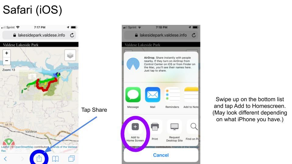
Below is an installation guide to add it to your homescreen instead of being in the browser:
The following slide shows how to install the app in Android's Chrome browser.
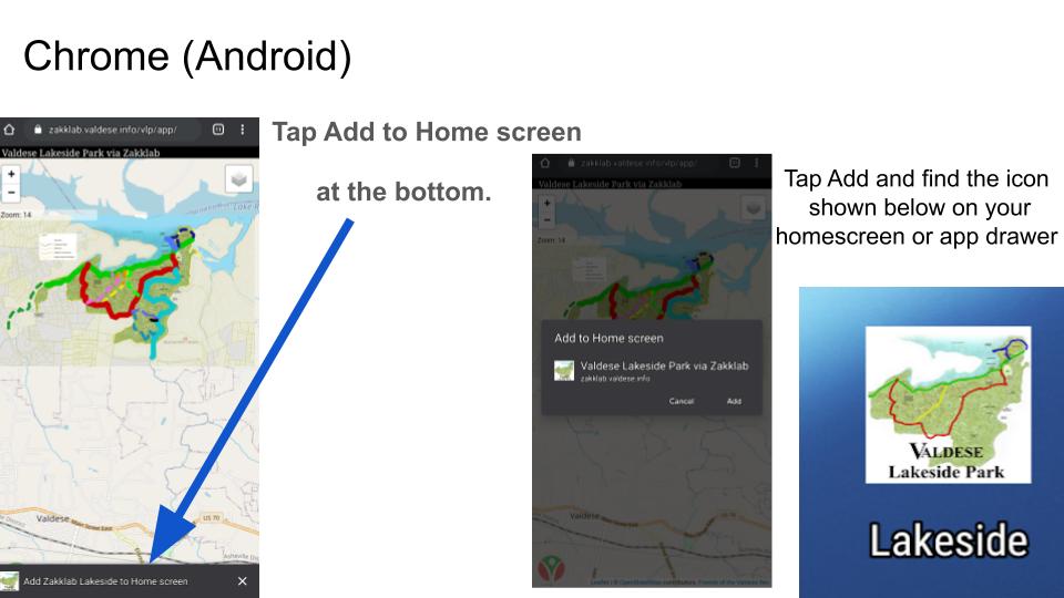
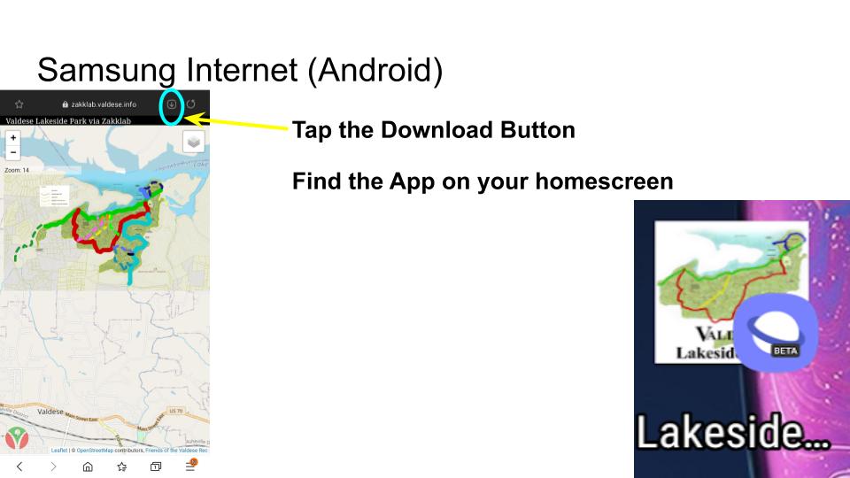
Tap  then Add to Home Screen
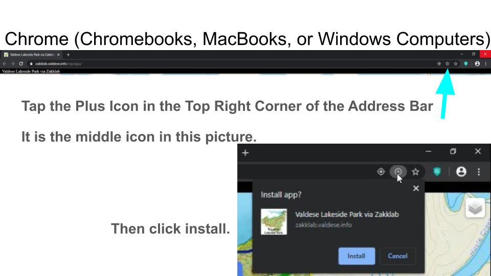
The following slide shows how to install the app in a typical desktop browser (Chrome).
The following slide shows how to install the app app in Samsung's browser.